We now have maps for avoiding trains!
Recently, residents were chatting online as residents do, when the plea for maps to get around the trains arose once again.
“We don’t need maps,” some said. “If you live here, you know how to get around the track.”
“But wait!” said others. “We really don’t know!”
Robert Yarboro, a long-time South Norfolkian, screen-shotted some maps, marked the routes, and shared them with the group in the Facebook thread.
We took Robert’s maps and revised them a little for better clarity on mobile phones, and we present them to you today!
We sincerely hope it helps.
Other ideas to keep you going on your way:
- Leave early. This train mess is going to be with us until 2020. And even then, there will still be trains blocking roads daily.
- Take the routes best traveled. Interstates don’t get blocked by trains. Navigate to the closest interstate to keep you on your way.
- Pack your patience when you travel. The trains should not block the road for more than 10 minutes at a time when it is not underway.
- If you get stuck waiting for a train, remember, you can always turn around and go another way. Please be careful while driving in South Norfolk.
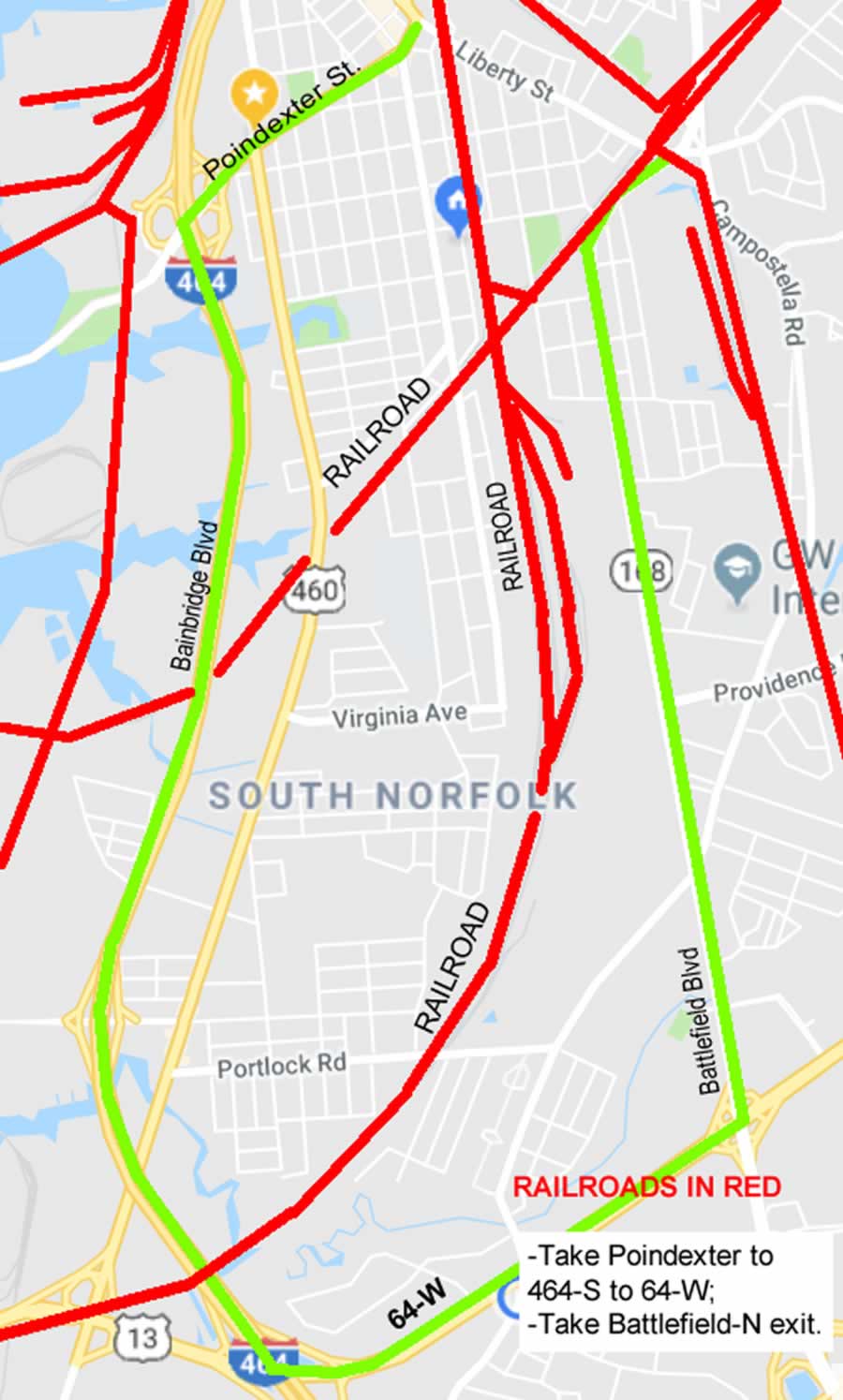
MAP 1 – Railroads are marked in red. Take Poindexter to 464-S. Take 464-S to 64-W. Then take the Battlefield-N exit.
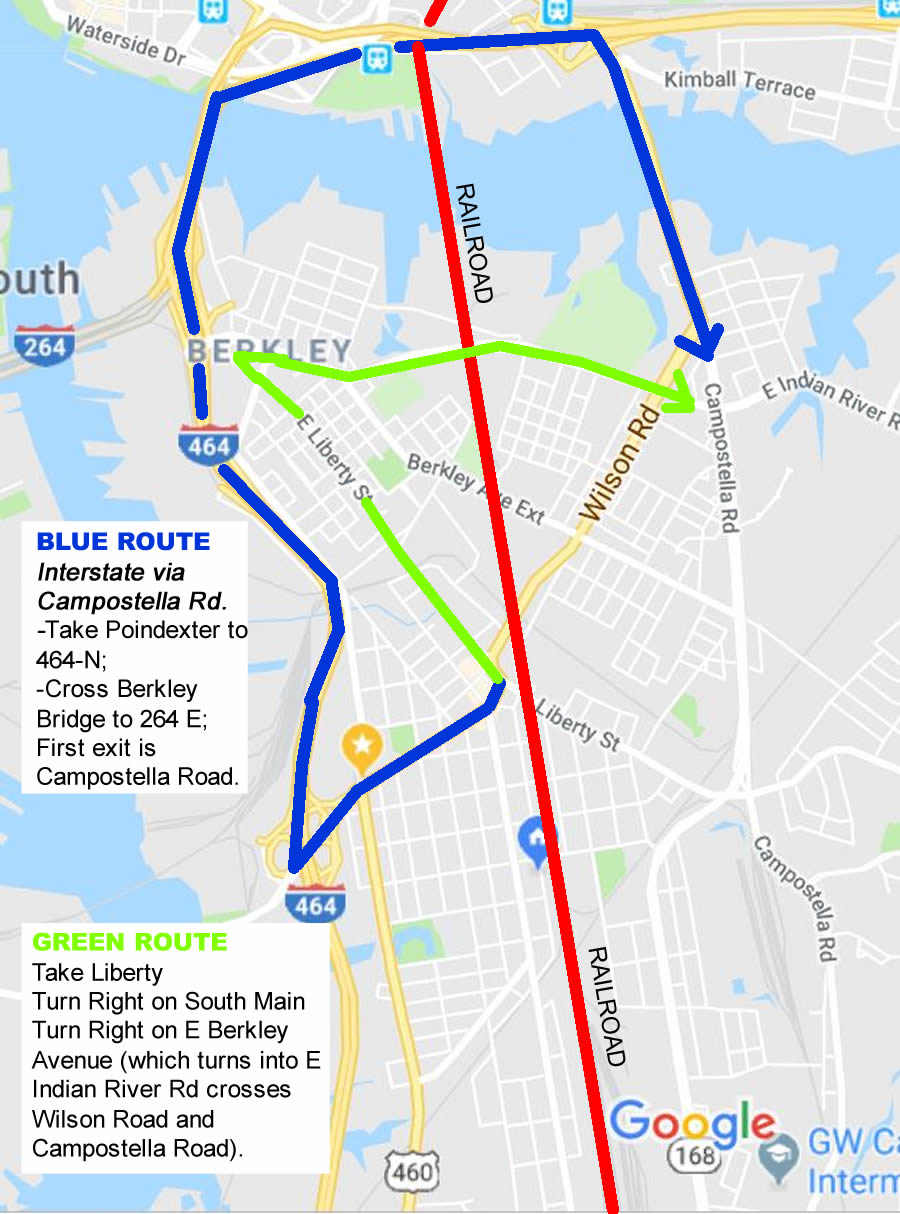
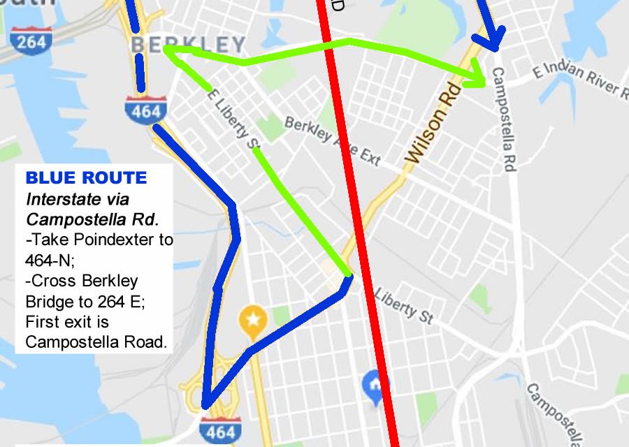
Map 2 – Blue Route – Interstate via Campostella Rd. Take Poindexter to 464-N. Cross Berkley Bridge to 264 E. First exit is Campostella Road.
Green Route – Take Liberty. Turn right on South Main. Turn Right on E. Berkley Avenue (which turns into E. Indian River Road and crosses Wilson Road and Campostella Road).


